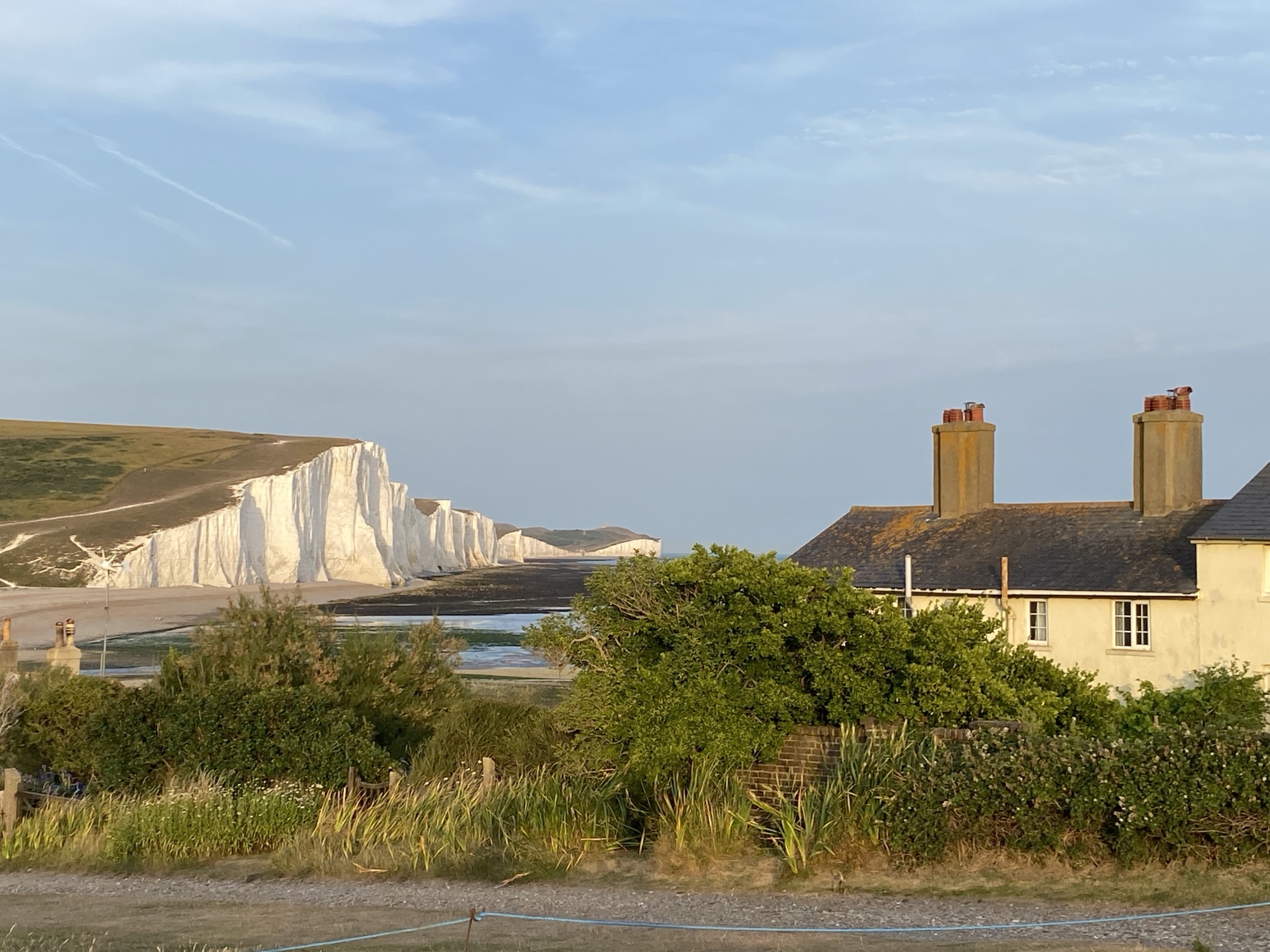

Heading East from The Cove in Fairlight, the King Charles III Coastal Path transitions from high, dramatic cliffs to expansive, low-lying wetlands and shingle reserves.
1. Cliff End and Pett Level
Leaving the pub, the trail initially heads inland through village roads to bypass areas of active cliff erosion.

Continue through the village along Sea Road at the far east of the village then transition through grassland meadows back to the shoreline and the clifftop overlooking the Channel.

Follow the path along a narrow trail that runs along an enclosed grass meadow. Once back on the clifftop, you’ll walk along an open, undulating path with sweeping views across Rye Bay.


As you ascend toward the cliff top you pass the marker showing you are entering the National Trust Fairlight Cliff.

Continue along the trail through a small wooded area and more grassland meadows before entering an area of high thick hedges.
As you emerge, the path will follow the high line of the cliffs. Walking through the tree-line you will pass a number of very fine properties on your left hand side, whilst seaward, through the odd break in the trees you are rewarded with some fine views of Pett Level Beach and Rye Bay.

As you start your descent you will glimpse some thatched properties on your left signalling that you are nearing the village of Cliff End.
The path descends steeply to sea level passing some more attractive properties until the path emerges on Pett Level Road in the heart of Cliff End.
Turn right and walk down Pett Level Road through the village until you reach the Royal Military Canal, the south-western terminus of a 28-mile (45 km) defensive waterway originally built to protect against a Napoleonic invasion.
Cliff End is the definitive starting (or ending) point of the canal. It sits at the foot of the Fairlight Cliffs, where the flat landscape of the Pett Level meets the steep, rocky ascent toward Hastings. The canal was built in two distinct parts. The section at Cliff End is the smaller southern stretch that runs roughly 6 miles to Winchelsea Hill.
Like the rest of the canal, this stretch was designed with a “zig-zag” or staggered layout. “Kinks” were placed roughly every 500 yards to allow artillery to fire down the length of the water (enfilade fire) at any invading troops.
The landward side features an earthen embankment (parapet) and a military road, while the seaward side originally had a towpath for troop barges.

In front of you will be an interesting property decorated with a number of animal lanterns.


Turn right here and follow the path until you reach a small set of stairs that will take you on to the Promenade at Cliff End.
2. Pett Level Beach to Winchelsea Beach
As you emerge onto the concrete promenade take a moment to look right toward Fairlight Cliffs you will see a prominent, large building perched on the clifftop that resembles a private fortress. This building is ‘Stonewalls’, a large, private residence located at the very edge of the cliff. Built in the 1930s, it is often described as an “art-deco pile” or a castle-like property. Its grand, imposing presence on the elevated clifftop gives it the appearance of a coastal fortification.


Continue along the promenade path, past a caravan site on your left, to the Pett Level Rescue Service. This is also a great place to grab a coffee and snack at small cafe opposite the boat huts
The “current” Pett Level rescue service is provided by the Pett Level Independent Rescue Boat (PLIRB), a 100% volunteer-led charity founded in 1970. Unlike the historic RNLI station, they operate entirely independently of the RNLI and receive no public funding.
They currently operate two Rigid Inflatable Boats (RIBs): John and Margaret Pulfer: A 5.4m primary rescue boat and Arancia: A smaller 3.66m surf RIB designed specifically for navigating the treacherous shallow waters under the cliffs
They use a unique, reconditioned dumper truck with hydraulic winches to launch boats over the shifting shingle you see on the beach.


The promenade comes to a natural end where the route aligns with the start of Pett Level Road, where walkers pass the prominent sea wall. Instead of walking on the road itself, the designated National Trail typically utilizes the concrete sea wall or the adjacent shingle beach, running parallel to Pett Level Road.

To the north (inland) of the road are the Pett Pools, which flank the inland side of the sea wall. This area is a birdwatcher’s paradise, consisting of a series of large, shallow brackish lagoons managed as part of the wider Pett Level landscape.

The pools are situated between the Royal Military Canal to the north and the Sea Wall to the south. Because they sit below sea level, they are protected by the massive shingle embankment you’ll be walking on. The area is a mosaic of open water, reed beds, and wet grazing marsh.

Lining the edges of the pools, the reed beds provide a dense habitat for Bearded Tits and Cetti’s Warblers. In summer, the air is thick with the sound of warblers; in winter, you might see a Bittern creeping through the golden reeds.

Walking along the elevated path you can observe the sluice systems that manage the water levels, crucial for maintaining the specific salinity levels that support rare invertebrates and plants found here.
Directly opposite the pools on the beach side (at low tide), you can sometimes see the remains of a Prehistoric Sunken Forest. Stumps of ancient oak and hazel are preserved in the peat, offering a strange visual mirror to the living marshland of the pools just a few metres away.

The path follows this flat, open coastal margin toward Winchelsea Beach and eventually enters the Rye Harbour Nature Reserve.


On the inward side of the path you will note the landscape has changed to grassland, ideal local farmers to graze their sheep.


As you near the town of Winchelsea Beach the path splits from Pett Level Road past the Winchelsea Beach Cafe and continues along the raised wall and the shingle beach. If you prefer a more stable footing then you have the option to walk on the path running alongside the sea wall.
Continue past a number of holiday caravans to the playing fields of Smeaton’s Harbour – an 18th century harbour taking 63 years to complete. The harbour only opened for 4 months before it silted up. John Smeaton acted as a consultant on the disastrous New Harbour at Rye, designed to combat the silting of the port of Winchelsea. The project is now known informally as “Smeaton’s Harbour ”, but it closed within months of opening, as mobile shingle blocked the entrance.
3. Rye Harbour Nature Reserve
At the entrance to the Rye Harbour Nature Reserve it was evident that there was clean-up activity taking place following the discovery of bio-beads as a result of a breach at the Eastbourne Water Treatment Facility.

On the left of the footpath some more inland lakes providing an ideal refuge for a variety of wildlife.

As you continue along the footpath you will reach the wall of baskets filled with rock, designed to stop the shingle from flowing across this low point in the road and blocking it during exceptional storm events. Gabion is from Italian gabbione meaning “big cage”. Along the shore there are the remains of decaying wooden groynes that once slowed the movement of shingle. The fencing inland of the road is to provide safe nesting sites for Oystercatcher and Ringed Plover and safe roosting sites for Curlew and gulls.
On the right is the Mary Stanford Lifeboat House, a desolate, historic building commemorating a 1928 tragedy. On 15th November 1928, the Mary Stanford lifeboat was launched to save a stricken vessel. Facing extreme weather conditions, the crew of 17 brave men never returned to shore, resulting in the biggest loss of life from a single lifeboat in the history of the RNLI. The Lifeboat House still stands but was never used again. This was the closest point to Rye Harbour that the crew could reach the shore. All the land behind the shingle ridges would have been saltmarsh


A bit further along you can just about make out the Gasson Ruin. All that remains of this building is the concrete wall in front of you. Look out for the interpretation board that shows a photo of the original building, taken in the 1930s. This is also a good area for some shingle flowers.Look out for the Yellow Horned-poppy, Viper’s Bugloss and Sea Kale.


Top the left you will note a large inland pool, named after the Common Terns that have nested here since the reserve was established in 1970. They nest on the islands that have been created for them. The birdwatching hide was first opened in 1973 and is named after Guy Crittall, the first chairman of the Friends of Rye Harbour Nature Reserve. The hides are always open and give a closer view of the bird.

As you approach the entrance to the River Rother you note the massive concrete wall, designed to catch the shingle and keeps the Harbour of Rye open for big ships. In winter the compound is where the shingle is loaded on to lorries and transported back towards the cliffs at Pett Level. There is usually lots of marine animals and plants washed up here and the Turnstones and gulls can find an easy meal.

The two pillbox’s, one at the mouth of the river and the other a bit further along the River Rother were completed in August, when the Battle of Britain was being fought in the skies overhead. Both pillboxe’s were abandoned by 1941, as they were too distant from the main defence line further inland.


As you walk inland towards the Discovery Centre, the land on your left was excavated in the 1930’s to make concrete blocks that would build Dover Harbour. The nature reserve has carefully let the sea in and created islands that are protected from disturbance.

The Discovery Centre is a modern facility operated by the Sussex Wildlife Trust, featuring a café and bird-watching information.
The path follows the mouth of the River Rother mouth inland, passing a famous red-roofed shrimper’s shed before concluding at Rye Harbour village.


This leg of the journey concluded at the Discovery Centre. As I made my way to the to the bus stop via the harbour road you’ll encounter two large, decommissioned maritime buoys resting on the shingle beside the road. These striking red and white structures are historical markers of the area’s nautical heritage
The First Buoy is a 3rd class spherical fairway marker that was originally placed two miles off the coast of Rye in 1971 by ‘Alsfords Wharf’. Its purpose was to mark a safe anchoring position for large vessels carrying timber and aggregates, which had to wait for the high tide before they could safely enter the harbour.
The Second Buoy is located a short distance further along the road toward the village, this buoy is similar in style and serves as a companion monument, reinforcing the visual connection between the road and the sea


The church visible from Harbour Road as you approach the village is the Church of the Holy Spirit. Originally built in 1849 in the Gothic Revival style using local blue stone and Caen stone, it was designed by the distinguished architect Samuel Sanders Teulon. The church’s most famous feature is its 1912 chancel roof, which is famously shaped like an upturned boat.

Leave a Reply