No visit to Hastings would be complete without taking the opportunity to visit Hastings Castle.
The route from Hastings train station to Hastings Castle is a short distance and can be completed by walking (around 16 minutes), taking a bus, or a short taxi ride. The castle is located on top of the West Hill cliff.
The walk is approximately 0.6 miles (about 1 km) and involves a short steep climb.
Exit Hastings Station and head south down Havelock Road toward the seafront. You will pass shops as you head through the pedestrianised area. Once at the seafront, head towards George Street (located near the black net huts). You have two options to get up the West Hill:
Walk up: Take the signposted pathways and Castle Hill Road from the Old Town/George Street area to the castle entrance at the top of the hill. This is a steep climb.
West Hill Cliff Railway: For an easier ascent, take the West Hill Funicular Railway from George Street. The top station is very close to the castle ruins.
Hastings Castle
Perched high atop the sandstone cliffs of West Hill, Hastings Castle is more than just a ruin; it is the physical imprint of the Norman Conquest that reshaped English history. Built by William the Conqueror in 1066, this fortress was the first Norman motte-and-Bailey castle in England. Today it offers a mixture of haunting stone ruins, ‘whispering’ dungeons, and panoramic views of the English Channel.
The story of Hastings Castle is one of constant transformation and dramatic survival.

Upon landing in 1066, William the Conqueror ordered a prefabricated wooden structure to be erected as a strategic base. After his victory at the Battle of Hastings, he ordered it to be rebuilt in stone.
In 1070, the Collegiate Church of St Mary was founded within the castle walls. It remained a hub for priests, students and choral singers long after the castle’s military importance faded.
Nature proved more formidable than any invading army. In 1287, violent storms caused the soft sandstone cliffs to collapse, sending the castle’s south wall and keep plunging into the sea. Today, less than half the original structure remains.
After the Dissolution of the Monasteries under Henry VIII, the site fell into ruin and was buried under undergrowth until it was excavated in 1824 and reimagined as a Victorian tourist attraction.
Tour itinerary
The North Gate serves as the primary entrance to the ruins of Hastings Castle.
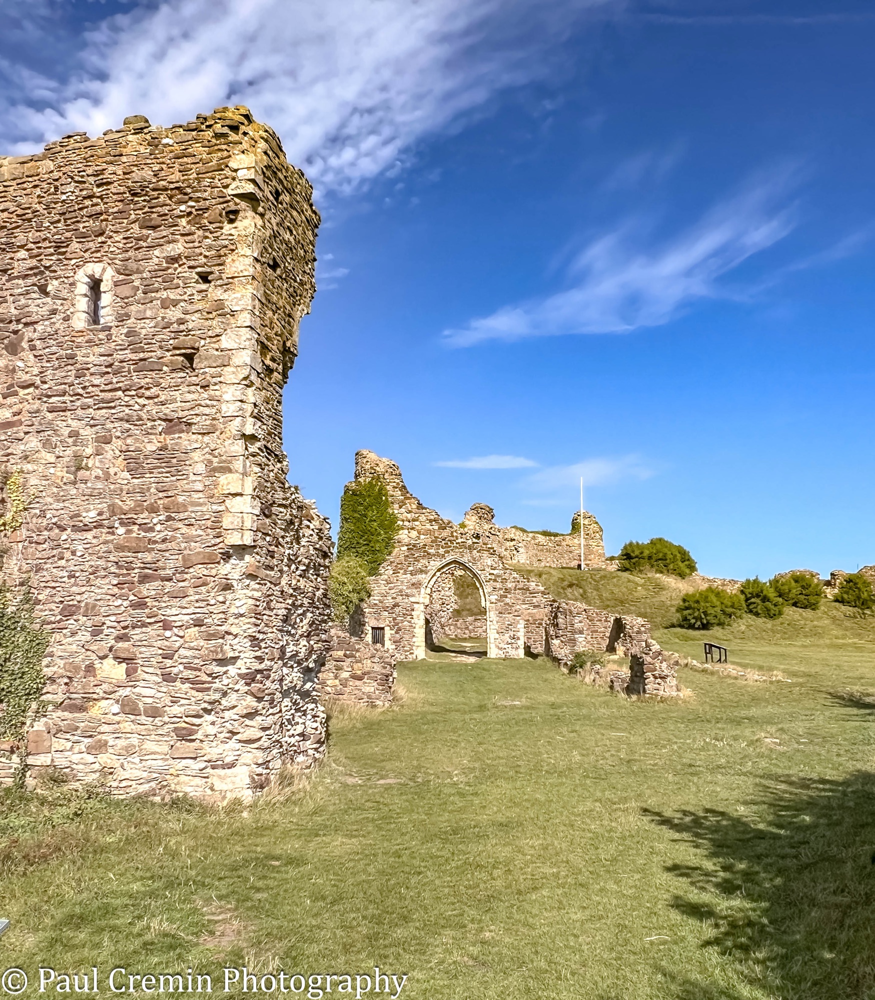
North Gate: In its prime, the North Gate was a substantial stone structure. Excavations in the 19th century revealed it was approximately 9 feet wide by 19 feet deep. You can still see the portcullis grooves in the stonework, where a heavy timber gate would have been lowered to trap or block intruders.
Archaeological digs in 1824 uncovered evidence of a drawbridge that once spanned a deep protective ditch outside the gate. The gate was once protected by two semi-circular towers, the foundations of which are still visible near the entrance.
Whispering Dungeons: Located just inside the North Gate, these rock-cut tunnels run deep into the castle mound. Originally used for storage, they later served as dark, atmospheric prison cells.
The Motte: Visit the northeast corner to see the remains of the original earthwork mound. While the original 12th-century stone keep that once stood here was lost to coastal erosion, the elevated mound still offers the castle’s highest vantage point.

Ladies’ Parlour: Located just beyond the east ditch, this flat area was historically a field for the castle’s canons and later became a popular spot for Victorian ladies to enjoy coastal views.
Chapel of St Mary (Holy Cross): These are the most extensive stone remains on-site. You can see the 110-foot long lower walls and the re-erected 12th-century chancel arch, which serves as the site’s primary ornament.


The church existed even before the Norman Conquest, with some architectural evidence suggesting pre-Conquest origins. Robert, Count of Eu, builder of the castle, founded a college of priests there around 1090. The church functioned as both a collegiate and parochial church until it fell into ruin by the end of the 16th century, largely due to coastal erosion causing the southern part of the castle to collapse into the sea.


The East Gate & Portcullis Grooves: Dating from roughly 1220, the remains of this gatehouse still show the vertical grooves where the heavy wooden portcullis would have been lowered to block entry.
East and North Walls: You can trace the perimeter of the fortress through the remaining sections of the stone walls and the foundations of the east gate towers.

Panoramic Views: The castle’s elevated position provides views of the English Channel, the Old Town of Hastings, and the modern coastline towards St Leonards.

Educational Displays
- “The 1066 Story” Cinema: Housed in a replica medieval siege tent, this 20-minute audio-visual program details the Norman invasion and the castle’s transformation from a wooden fort into a stone fortress.
- Information Boards: Situated throughout the ruins, these boards feature architectural plans that help you visualize the original scale of the castle before major sections fell into the English Channel.
Leave a Reply